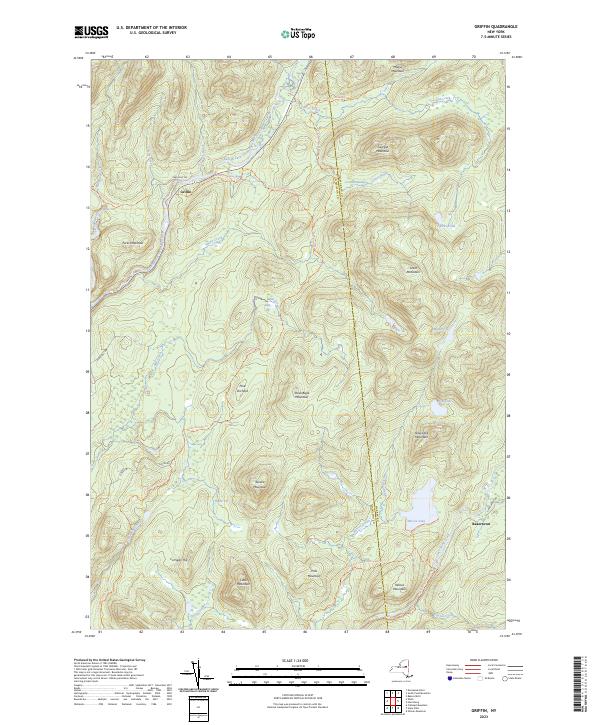
2023 Map of Griffin
USGS Topo · Published 2023About this map
The East Branch Sacandaga River carves through this remote stretch of the Adirondacks, defining the local landscape as it flows past the settlement of Griffin. This region is characterized by significant topographic variation, with peaks like Steve Bigle Mountain, Smith Mountain, and Moose Mountain rising above numerous wetlands and mountain ponds. The map records several distinctive vlys—low-lying marshy areas typical of the area—including Masher Vly, East Vly, and Taylor Vly.
Find a feature on this map
51 named features on this map. Tap any name to fly to it.
Don’t see what you’re looking for? This feature index may not catch every label — zoom into the map to look around manually.
Map Details
Editions of this 2023 Griffin Map
This is the sole edition of this map. No revisions or reprints were ever made.
Other maps of this area

1898 · Thirteenth Lake
USGS Topo · 1:62,500

1899 · Indian Lake
USGS Topo · 1:62,500

1902 · Indian Lake
USGS Topo · 1:62,500

1907 · Lake Pleasant
USGS Topo · 1:62,500

1910 · Stony Creek
USGS Topo · 1:62,500

1950 · Utica
USGS Topo · 1:250,000

1954 · Lake Pleasant
USGS Topo · 1:62,500

1954 · Thirteenth Lake
USGS Topo · 1:62,500

1954 · Indian Lake
USGS Topo · 1:62,500

1954 · Harrisburg
USGS Topo · 1:62,500