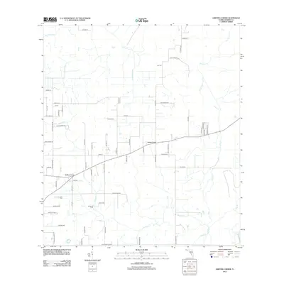
2012 Map of Griffins Corner
USGS Topo · Published 2012About this map
Lemon Grove and Griffins Corner anchor this rural Hardee County landscape, which by 2012 remains dominated by citrus groves, ranches, and fruit cultivation. The map captures the agricultural footprint of the region, specifically identifying the Diamond H Ranch and the Poucher Blueberry Farm. This citrus-belt terrain is defined by a dense network of local creeks including Little Charlie Creek, Buckhorn Creek, and Charlie Creek, which drain the low-lying lands around Poverty Hill.
Find a feature on this map
68 named features on this map. Tap any name to fly to it.
Don’t see what you’re looking for? This feature index may not catch every label — zoom into the map to look around manually.
Map Details
Editions of this 2012 Griffins Corner Map
This is the sole edition of this map. No revisions or reprints were ever made.
Other maps of this area

1953 · Frostproof
USGS Topo · 1:24,000

1953 · Avon Park
USGS Topo · 1:24,000

1953 · Crewsville
USGS Topo · 1:24,000

1955 · Bowling Green
USGS Topo · 1:24,000

1955 · Wauchula
USGS Topo · 1:24,000

1956 · Bereah
USGS Topo · 1:24,000

1956 · Sweetwater
USGS Topo · 1:24,000

1956 · Zolfo Springs
USGS Topo · 1:24,000

1956 · Griffins Corner
USGS Topo · 1:24,000

1956 · Fort Pierce
USGS Topo · 1:250,000