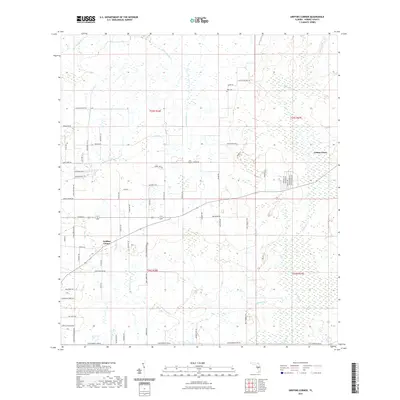
2021 Map of Griffins Corner
USGS Topo · Published 2021About this map
Griffins Corner serves as a primary geographic anchor in this section of Hardee County, where the landscape is defined by the drainage basins of Little Charlie Cr and Buckhorn Cr. The settlement pattern is largely agricultural and rural, characterized by a grid of named local routes like Jack Jones Rd and Webb Rd. In the northeast, the Lemon Grove area sits near the winding path of Charlie Cr, while the Hart Cem provides a specific point of interest for genealogists tracking local families. The southern portion of the map is notable for several named tracks and roads, including the distinctively named Steve Roberts Special and Brown Camp Rd. This survey reflects the modern rural infrastructure of the Florida interior, where natural watercourses like Fivemile Gully and Lake Dale Branch continue to influence the placement of homesteads and connector roads.
Find a feature on this map
73 named features on this map. Tap any name to fly to it.
Don’t see what you’re looking for? This feature index may not catch every label — zoom into the map to look around manually.
Map Details
Editions of this 2021 Griffins Corner Map
This is the sole edition of this map. No revisions or reprints were ever made.
Other maps of this area

1953 · Frostproof
USGS Topo · 1:24,000

1953 · Avon Park
USGS Topo · 1:24,000

1953 · Crewsville
USGS Topo · 1:24,000

1955 · Bowling Green
USGS Topo · 1:24,000

1955 · Wauchula
USGS Topo · 1:24,000

1956 · Bereah
USGS Topo · 1:24,000

1956 · Sweetwater
USGS Topo · 1:24,000

1956 · Zolfo Springs
USGS Topo · 1:24,000

1956 · Griffins Corner
USGS Topo · 1:24,000

1956 · Fort Pierce
USGS Topo · 1:250,000