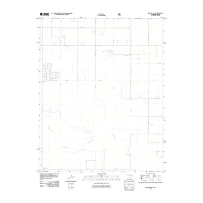
2011 Map of Griggs SW
USGS Topo · Published 2011About this map
The Beaver River winds through the southern portion of this high plains landscape, defining the primary natural drainage in a region dominated by a precise section-line road grid. Mapping from this era highlights the systematic agricultural development of Cimarron County, where a network of thoroughfares including E0300 Rd and N0450 Rd segment the territory into regular farm plots and grazing lands. The map illustrates how human settlement patterns have adapted to the semi-arid environment, with infrastructure following the rigid township and range survey lines. While the river course introduces the only significant topographic variation, the surrounding territory is primarily characterized by the intersection of rural routes like E0270 Rd and N0480 Rd, which serve as the lifelines for the local ranching and farming operations that define this Oklahoma panhandle borderland.
Find a feature on this map
22 named features on this map. Tap any name to fly to it.
Don’t see what you’re looking for? This feature index may not catch every label — zoom into the map to look around manually.
Map Details
Editions of this 2011 Griggs SW Map
This is the sole edition of this map. No revisions or reprints were ever made.
Other maps of this area

1954 · Dalhart
USGS Topo · 1:250,000

1958 · Dalhart
USGS Topo · 1:250,000

1962 · Dalhart
USGS Topo · 1:250,000

1964 · Kerrick
USGS Topo · 1:24,000

1964 · Stratford 2 NE
USGS Topo · 1:24,000

1964 · Stratford NE
USGS Topo · 1:24,000

1971 · Griggs SW
USGS Topo · 1:24,000

1971 · Griggs NE
USGS Topo · 1:24,000

1971 · Griggs
USGS Topo · 1:24,000

1971 · Sampsel Lake
USGS Topo · 1:24,000