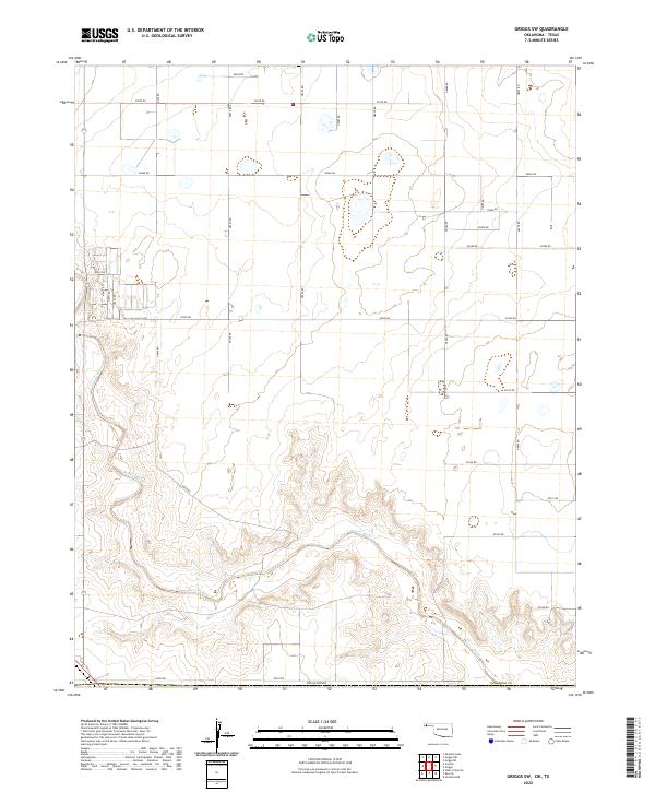
2022 Map of Griggs SW
USGS Topo · Published 2022About this map
Beaver River meanders across the southern landscape of Cimarron County in this Oklahoma Panhandle survey. The terrain is defined by the sharp contrast between the wide, meandering river valley and the vast, high plains that stretch to the north. A strict grid of section-line roads, including E0270 Rd and E0300 Rd, reveals the enduring influence of the Public Land Survey System on the region's agricultural layout. This geography is characteristic of the High Plains, where human settlement patterns are dictated by the presence of water and the relentless geometry of the section grid. In the western reaches, a cluster of local connectors like N0433 Rd and N0435 Rd suggests localized activity within the broader ranching and farming landscape that defines this portion of the state.
Find a feature on this map
34 named features on this map. Tap any name to fly to it.
Don’t see what you’re looking for? This feature index may not catch every label — zoom into the map to look around manually.
Map Details
Editions of this 2022 Griggs SW Map
This is the sole edition of this map. No revisions or reprints were ever made.
Other maps of this area

1954 · Dalhart
USGS Topo · 1:250,000

1958 · Dalhart
USGS Topo · 1:250,000

1962 · Dalhart
USGS Topo · 1:250,000

1964 · Kerrick
USGS Topo · 1:24,000

1964 · Stratford 2 NE
USGS Topo · 1:24,000

1964 · Stratford NE
USGS Topo · 1:24,000

1971 · Griggs SW
USGS Topo · 1:24,000

1971 · Griggs NE
USGS Topo · 1:24,000

1971 · Griggs
USGS Topo · 1:24,000

1971 · Sampsel Lake
USGS Topo · 1:24,000