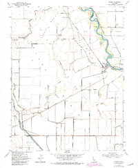
1954 Map of Grimes
USGS Topo · Published 1980About this map
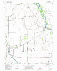
The Sacramento River meanders through this agricultural corridor of the Sacramento Valley, defining the eastern edge of the quadrangle with its distinctive oxbows and river bars. The settlement of Grimes serves as a central hub, adjacent to Grand Island School and the Grand Island Cemetery. This landscape is fundamentally shaped by the movement of water and rail, with the Southern Pacific tracks cutting across the basin to reach points like Sycamore Siding and Grains. The intricate network of drainage features, including the Colusa Basin Drainage Canal and numerous sloughs like Sycamore Slough, highlights the complex irrigation and flood control engineering required to maintain the productivity of the Colusa Basin and Jimeno Basin. Numerous landing strips and gages indicate the area's mid-century reliance on both small-scale aviation and careful river monitoring.
Find a feature on this map
34 named features on this map. Tap any name to fly to it.
Don’t see what you’re looking for? This feature index may not catch every label — zoom into the map to look around manually.
Map Details
Editions of this 1954 Grimes Map
5 editions found
Other maps of this area

1888 · Marysville
USGS Topo · 1:125,000

1891 · Marysville
USGS Topo · 1:125,000

1894 · Marysville
USGS Topo · 1:125,000

1895 · Marysville
USGS Topo · 1:125,000

1905 · Harrington
USGS Topo · 1:24,000

1907 · Dunnigan
USGS Topo · 1:62,500

1907 · Colusa
USGS Topo · 1:62,500

1911 · Grimes
USGS Topo · 1:31,680

1912 · Marysville Buttes
USGS Topo · 1:31,680

1912 · Meridian
USGS Topo · 1:31,680