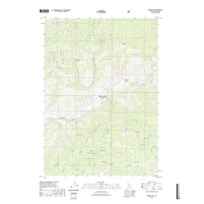
2020 Map of Grimes Pass
USGS Topo · Published 2020About this map
Grimes Pass serves as a central landmark within the Boise National Forest in this 2020 record of Boise County’s high country. The landscape is defined by the South Fork Payette River and an intricate network of drainage systems, including Danskin Creek and Grimes Cr. The map details a rugged topography marked by numerous gulches, such as Ader Gulch, Miller Gulch, and Wet Gulch, which suggest a history of resource extraction and local land use.
Find a feature on this map
90 named features on this map. Tap any name to fly to it.
Don’t see what you’re looking for? This feature index may not catch every label — zoom into the map to look around manually.
Map Details
Editions of this 2020 Grimes Pass Map
This is the sole edition of this map. No revisions or reprints were ever made.
Other maps of this area

1894 · Idaho Basin
USGS Topo · 1:125,000

1909 · Garden Valley
USGS Topo · 1:125,000

1955 · Hailey
USGS Topo · 1:250,000

1957 · Placerville
USGS Topo · 1:24,000

1957 · Pioneerville
USGS Topo · 1:24,000

1957 · Challis
USGS Topo · 1:250,000

1959 · Hailey
USGS Topo · 1:250,000

1959 · Garden Valley
USGS Topo · 1:62,500

1960 · Challis
USGS Topo · 1:250,000

1962 · Hailey
USGS Topo · 1:250,000