
1957 Map of Pioneerville
USGS Topo · Published 1959About this map
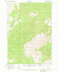
Pioneerville sits at the heart of this gold-mining landscape, where the confluence of Grimes Creek and Clear Creek facilitated intensive hydraulic and lode operations. The map documents a terrain heavily modified by industry, specifically noting Tailings along the creek beds and a dense concentration of hard-rock mines in the southeast. Significant family-named locations such as the Arbaugh Ranch and numerous gulches named for minerals or provisions—including Lager Beer Gulch and Charcoal Creek—point to the area's colorful history as a center of the Idaho Basin gold rush. Beyond the primary settlement, the map reveals an extensive network of Jeep Trails and prospects reaching toward Wilson Peak. Researchers will find evidence of long-standing mining infrastructure at the Washington Mill and legacy claims like the Gambrinus Mine and Little Klondike Mine.
Find a feature on this map
56 named features on this map. Tap any name to fly to it.
Don’t see what you’re looking for? This feature index may not catch every label — zoom into the map to look around manually.
Map Details
Editions of this 1957 Pioneerville Map
4 editions found
Other maps of this area

1894 · Idaho Basin
USGS Topo · 1:125,000

1909 · Garden Valley
USGS Topo · 1:125,000

1955 · Hailey
USGS Topo · 1:250,000

1957 · Placerville
USGS Topo · 1:24,000

1957 · Warm Springs Point
USGS Topo · 1:24,000

1957 · Idaho City
USGS Topo · 1:24,000

1957 · Challis
USGS Topo · 1:250,000

1959 · Hailey
USGS Topo · 1:250,000

1959 · Garden Valley
USGS Topo · 1:62,500

1960 · Challis
USGS Topo · 1:250,000