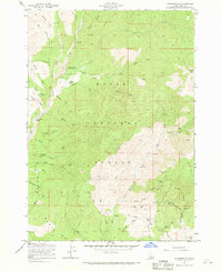
1957 Map of Pioneerville
USGS Topo · Published 1960About this map
Pioneerville serves as the focal point of this late 1950s survey, situated within the Boise National Forest where gold mining legacies mark the landscape. The map reveals a high concentration of lode mining activity concentrated in the southern gulches, particularly around Washington Gulch and Gambrinus Gulch. Here, researchers can locate industrial sites like the Washington Mill alongside numerous workings such as the Mascot Mine, Illinois Mine, and the Lucky Boy Mine. The terrain is defined by a dense network of drainages including Grimes Creek and Clear Creek, which carved the steep gulches where many of these claims were established. Beyond the larger mining operations, the presence of the Arbaugh Ranch and scattered labels for prospects and shafts illustrate the persistence of individual mining efforts and small-scale settlement in this corner of the Boise Basin.
Find a feature on this map
55 named features on this map. Tap any name to fly to it.
Don’t see what you’re looking for? This feature index may not catch every label — zoom into the map to look around manually.
Map Details
Editions of this 1957 Pioneerville Map
4 editions found
Other maps of this area

1894 · Idaho Basin
USGS Topo · 1:125,000

1909 · Garden Valley
USGS Topo · 1:125,000

1955 · Hailey
USGS Topo · 1:250,000

1957 · Placerville
USGS Topo · 1:24,000

1957 · Pioneerville
USGS Topo · 1:24,000

1957 · Warm Springs Point
USGS Topo · 1:24,000

1957 · Idaho City
USGS Topo · 1:24,000

1957 · Challis
USGS Topo · 1:250,000

1959 · Hailey
USGS Topo · 1:250,000

1959 · Garden Valley
USGS Topo · 1:62,500