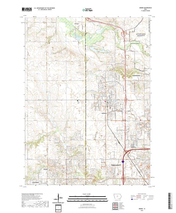
2022 Map of Grimes
USGS Topo · Published 2022About this map
Grimes and Urbandale anchor this detailed survey of the expanding suburban landscape northwest of Des Moines. The map documents a dense network of modern residential development and commercial corridors, contrasting with the remaining agricultural sections in the north. The winding course of Beaver Creek and its tributary Little Beaver Cr define the drainage patterns of the eastern half, while Walnut Cr and Little Walnut Cr navigate the southern and western reaches. For those researching local history or genealogy, the map identifies significant landmarks such as Hoff Prairie Cem and Sunny Hill Cem. The transition from rural township lines, such as t80n r26w and t79n r25w, to the modern city limits of Johnston, Clive, and Waukee illustrates the rapid evolution of the Des Moines metropolitan fringe.
Find a feature on this map
77 named features on this map. Tap any name to fly to it.
Don’t see what you’re looking for? This feature index may not catch every label — zoom into the map to look around manually.
Map Details
Editions of this 2022 Grimes Map
This is the sole edition of this map. No revisions or reprints were ever made.
Other maps of this area

1905 · Des Moines
USGS Topo · 1:62,500

1907 · Des Moines
USGS Topo · 1:62,500

1908 · Waukee
USGS Topo · 1:62,500

1911 · Madrid
USGS Topo · 1:62,500

1911 · Slater
USGS Topo · 1:62,500

1913 · Slater
USGS Topo · 1:62,500

1914 · Madrid
USGS Topo · 1:62,500

1954 · Des Moines
USGS Topo · 1:250,000

1956 · Des Moines
USGS Topo · 1:250,000

1956 · Des Moines NW
USGS Topo · 1:24,000