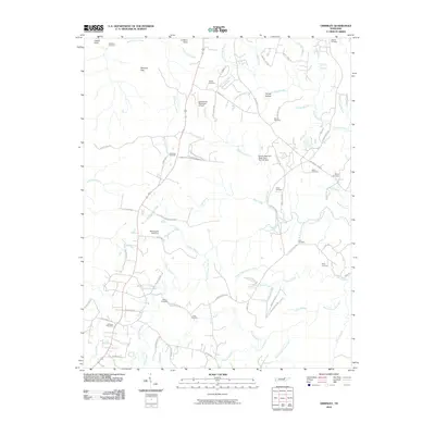
2010 Map of Grimsley
USGS Topo · Published 2010About this map
The Grimsley Post Office anchors the southwestern portion of this Tennessee plateau landscape, where the headwaters of numerous creeks begin their descent through deep hollows and gaps. The terrain is defined by complex drainage patterns, with the North Prong Clear Fork and South Prong Horse Creek carving the land alongside prominent landmarks like Lookout Point and Raccoon Gap. For those researching local families, the map reveals a high density of rural burial grounds, including the Roanoke Cemetery, Stephens Cemetery, and Ward Cemetery, often located near crossroads and old farm roads. The arrival of modern infrastructure is represented by the Jamestown Municipal Airport and the Mar-Jeanne Lake Dam, while the natural character of the region remains evident at Magendanz Falls Waterfall on the eastern edge.
Find a feature on this map
93 named features on this map. Tap any name to fly to it.
Don’t see what you’re looking for? This feature index may not catch every label — zoom into the map to look around manually.
Map Details
Editions of this 2010 Grimsley Map
This is the sole edition of this map. No revisions or reprints were ever made.
Other maps of this area

1895 · Wartburg
USGS Topo · 1:125,000

1896 · Wartburg
USGS Topo · 1:125,000

1897 · Standingstone
USGS Topo · 1:125,000

1898 · Standingstone
USGS Topo · 1:125,000

1935 · Clarkrange
USGS Topo · 1:24,000

1936 · Twin Bridges
USGS Topo · 1:24,000

1936 · Jones Knob
USGS Topo · 1:24,000

1943 · Twin Bridges
USGS Topo · 1:24,000
1945 · Twin Bridges
USGS Topo · 1:24,000

1946 · Clarkrange
USGS Topo · 1:24,000