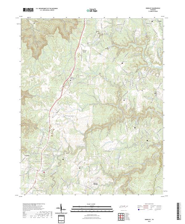
2022 Map of Grimsley
USGS Topo · Published 2022About this map
Grimsley and Banner Springs anchor this portion of Fentress County, where the Cumberland Plateau is deeply incised by the drainage of the N Prong Clear Fork. The landscape is characterized by a transition from the agricultural uplands near Allardt to the complex gorge systems of Buffalo Cove and Gwinn Cove. A notable aviation landmark, the Jamestown Municipal Airport, sits along the central ridge, while the surrounding countryside is dotted with small, family-associated burial grounds such as Spurlin Cem and Beaty Cem. The road network, including the winding Stephens Loop and Banner Roslin Rd, follows the topography of the ridges between Brushy Fork and S Prong Horse Cr. This 2022 survey documents the modern layout of these rural Tennessee communities, where water features like Falling Water Br continue to carve the plateau edge near Lookout Point.
Find a feature on this map
149 named features on this map. Tap any name to fly to it.
Don’t see what you’re looking for? This feature index may not catch every label — zoom into the map to look around manually.
Map Details
Editions of this 2022 Grimsley Map
This is the sole edition of this map. No revisions or reprints were ever made.
Other maps of this area

1895 · Wartburg
USGS Topo · 1:125,000

1896 · Wartburg
USGS Topo · 1:125,000

1897 · Standingstone
USGS Topo · 1:125,000

1898 · Standingstone
USGS Topo · 1:125,000

1935 · Clarkrange
USGS Topo · 1:24,000

1936 · Twin Bridges
USGS Topo · 1:24,000

1936 · Jones Knob
USGS Topo · 1:24,000

1943 · Twin Bridges
USGS Topo · 1:24,000
1945 · Twin Bridges
USGS Topo · 1:24,000

1946 · Clarkrange
USGS Topo · 1:24,000