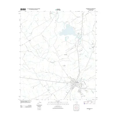
2013 Map of Groesbeck
USGS Topo · Published 2013About this map
Groesbeck serves as the focal point of this Limestone County landscape, where the local street grid meets the winding course of the Navasota River. The geography is defined by its water sources, from the expansive Springfield Lake to the smaller Springfield Springs and Baines Cr. This area is particularly rich for genealogical research, preserving the locations of numerous burial grounds including Dancer Cem, Springfield Cem, and the Faulkenberry Cem.
Find a feature on this map
79 named features on this map. Tap any name to fly to it.
Don’t see what you’re looking for? This feature index may not catch every label — zoom into the map to look around manually.
Map Details
Editions of this 2013 Groesbeck Map
This is the sole edition of this map. No revisions or reprints were ever made.
Other maps of this area

1920 · Mexia
USGS Topo · 1:62,500

1954 · Waco
USGS Topo · 1:250,000

1955 · Waco
USGS Topo · 1:250,000

1957 · Groesbeck
USGS Topo · 1:62,500

1960 · Echols
USGS Topo · 1:24,000

1960 · Groesbeck
USGS Topo · 1:24,000

1960 · Tehuacana
USGS Topo · 1:24,000

1963 · Mexia
USGS Topo · 1:24,000

1966 · Thornton
USGS Topo · 1:24,000
1966 · Box Church
USGS Topo · 1:24,000