
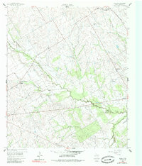
1960 Map of Echols
USGS Topo · Published 1961About this map
Coolidge and its surrounding Limestone County farmland define this 1960 landscape, where the Navasota River and its tributaries carve wooded paths through the prairie. The settlement pattern is anchored by a network of rural institutions, including Mustang Chapel to the west and the small community of Echols to the east. The presence of several burial grounds, such as Hill Cem and the New Armour Cem, points to established family roots in these rural blocks.
Find a feature on this map
18 named features on this map. Tap any name to fly to it.
Don’t see what you’re looking for? This feature index may not catch every label — zoom into the map to look around manually.
Map Details
Editions of this 1960 Echols Map
2 editions found
Other maps of this area

1920 · Mart
USGS Topo · 1:62,500

1954 · Waco
USGS Topo · 1:250,000

1955 · Waco
USGS Topo · 1:250,000

1956 · Hubbard
USGS Topo · 1:24,000

1956 · Mart
USGS Topo · 1:24,000

1957 · Prairie Hill
USGS Topo · 1:24,000

1957 · Groesbeck
USGS Topo · 1:62,500

1960 · Groesbeck
USGS Topo · 1:24,000

1960 · Tehuacana
USGS Topo · 1:24,000

1965 · Coolidge
USGS Topo · 1:24,000