
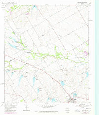
1965 Map of Coolidge
USGS Topo · Published 1967About this map
The town of Coolidge serves as the primary hub on this mid-1960s survey of the Texas Blackland Prairies, situated near the intersection of Limestone, Hill, and Navarro counties. This era of the landscape is defined by extensive flood control and water management, evidenced by a series of numbered dams—from Dam No 6 in the north to Dam No 10 and Dam No 16 in the southeast—that regulate the flow of the North Fork and Munger Branch. Smaller, scattered settlements like Munger and Eldorado Center reflect the agricultural character of the region, while the Dover Cem stands as a quiet marker of local family history near the Pin Oak Creek bottomlands. The map also documents the industrial footprint of the time through prominent pipelines and a Gaging Sta used for monitoring the local creek network.
Find a feature on this map
33 named features on this map. Tap any name to fly to it.
Don’t see what you’re looking for? This feature index may not catch every label — zoom into the map to look around manually.
Map Details
Editions of this 1965 Coolidge Map
2 editions found
Other maps of this area

1920 · Mart
USGS Topo · 1:62,500

1954 · Waco
USGS Topo · 1:250,000

1955 · Waco
USGS Topo · 1:250,000

1956 · Hubbard
USGS Topo · 1:24,000

1956 · Dawson
USGS Topo · 1:24,000

1957 · Irene
USGS Topo · 1:24,000

1957 · Prairie Hill
USGS Topo · 1:24,000

1957 · Groesbeck
USGS Topo · 1:62,500

1960 · Echols
USGS Topo · 1:24,000

1960 · Tehuacana
USGS Topo · 1:24,000