1956 Map of Dawson
USGS Topo · Published 1957About this map
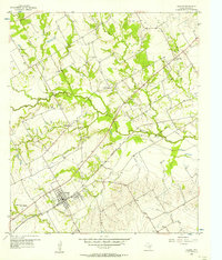
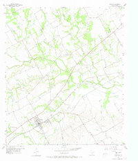
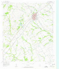
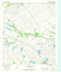
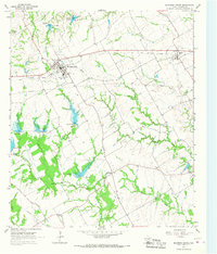
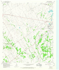
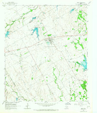
Dawson stands as the primary hub in this mid-1950s survey of Navarro County, situated along the St Louis Southwestern railroad line. The landscape is defined by the broad floodplain of Richland Creek and its many tributaries, including Wolf Creek and Post Oak Creek. The map documents a rural transition, notably marking Alliance Hall (Aban'd) and the small settlements of Silver City and Spring Hill. Genealogists will find particular value in the documentation of the Spring Hill Cem and the Battle Creek Burial Ground Historical Marker, which preserves local history near the banks of Battle Creek. Infrastructure of the era is represented by an active Pipeline, multiple Oil Tanks, and a Pumping Sta, reflecting the importance of the energy industry to this region of North Central Texas.
Find a feature on this map
25 named features on this map. Tap any name to fly to it.
Don’t see what you’re looking for? This feature index may not catch every label — zoom into the map to look around manually.
Map Details
Editions of this 1956 Dawson Map
2 editions found
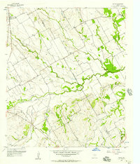
Other maps of this area

1954 · Dallas
USGS Topo · 1:250,000

1954 · Waco
USGS Topo · 1:250,000

1955 · Waco
USGS Topo · 1:250,000
1956 · Hubbard
USGS Topo · 1:24,000
1957 · Irene
USGS Topo · 1:24,000

1958 · Dallas
USGS Topo · 1:250,000
1965 · Coolidge
USGS Topo · 1:24,000
1965 · Blooming Grove
USGS Topo · 1:24,000
1965 · Corbet
USGS Topo · 1:24,000
1965 · Frost
USGS Topo · 1:24,000