1956 Map of Dawson
USGS Topo · Published 1973About this map
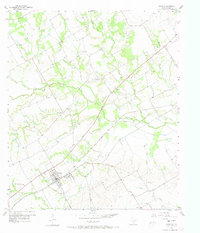
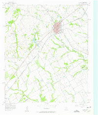
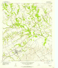
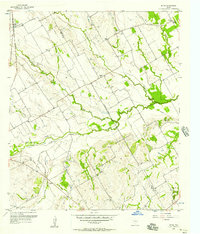
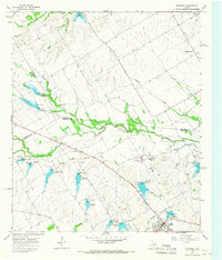
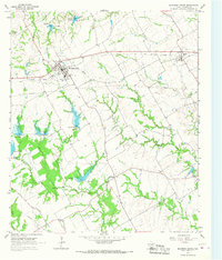
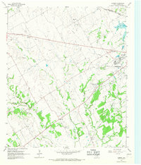
Dawson serves as the primary hub of this 1950s Texas landscape, featuring an Athletic Field and localized industry near the St Louis Southwestern Railroad Grade. The terrain is deeply tied to the agricultural and commemorative history of Navarro County, marked significantly by the Battle Creek Burial Ground Historical Marker in the southwest. A network of rural communities such as Silver City and Spring Hill are connected by a web of creek systems, including Richland Creek and Battle Creek. Local genealogy is well-supported by several burial sites, including Younger Cem and Spring Hill Cem, while rural life is centered around community structures like Brushie Prairie Ch and Alliance Hall (Alex'd). The appearance of Oil Tanks and various pipelines indicates the gradual introduction of energy infrastructure into this traditional farming and ranching region.
Find a feature on this map
25 named features on this map. Tap any name to fly to it.
Don’t see what you’re looking for? This feature index may not catch every label — zoom into the map to look around manually.
Map Details
Editions of this 1956 Dawson Map
2 editions found
Other maps of this area

1954 · Dallas
USGS Topo · 1:250,000

1954 · Waco
USGS Topo · 1:250,000

1955 · Waco
USGS Topo · 1:250,000
1956 · Hubbard
USGS Topo · 1:24,000
1956 · Dawson
USGS Topo · 1:24,000
1957 · Irene
USGS Topo · 1:24,000

1958 · Dallas
USGS Topo · 1:250,000
1965 · Coolidge
USGS Topo · 1:24,000
1965 · Blooming Grove
USGS Topo · 1:24,000
1965 · Corbet
USGS Topo · 1:24,000