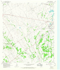
1965 Map of Corbet
USGS Topo · Published 1967About this map
Corsicana and its western outskirts during the mid-1960s reveal a landscape transitioning between agricultural roots and mid-century institutional expansion. The presence of the State Orphans Home and the Odd Fellows and Rebekah Home for Children highlights a period when significant social and benevolent institutions were central to the community's identity. These sites, along with Memorial Hospital, are situated near several active rail lines including the St Louis Southwestern and the Chicago Rock Island and Pacific. In the surrounding countryside, historical continuity is maintained through numerous local burying grounds such as Cunningham Cem and Black Hills Cem, alongside several rural houses of worship like Whites Chapel and Mt Moriah Ch. An Old Railroad Grade cutting across the north provides a trace of earlier transportation routes that once serviced the Black Hills area.
Find a feature on this map
28 named features on this map. Tap any name to fly to it.
Don’t see what you’re looking for? This feature index may not catch every label — zoom into the map to look around manually.
Map Details
Editions of this 1965 Corbet Map
2 editions found
Other maps of this area

1954 · Dallas
USGS Topo · 1:250,000

1954 · Waco
USGS Topo · 1:250,000

1955 · Waco
USGS Topo · 1:250,000

1956 · Dawson
USGS Topo · 1:24,000

1958 · Dallas
USGS Topo · 1:250,000

1961 · Chatfield
USGS Topo · 1:24,000

1962 · Emhouse
USGS Topo · 1:24,000

1962 · Cryer Creek
USGS Topo · 1:24,000

1963 · Richland
USGS Topo · 1:24,000
1965 · Corsicana
USGS Topo · 1:24,000