
1962 Map of Emhouse
USGS Topo · Published 1965About this map
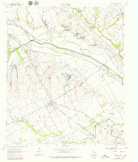
The agricultural plains of the Ellis Co Navarro Co border are defined by the convergence of several major watercourses, most notably Chambers Creek and its complex system of sloughs and reservoirs. Surveyed in the early 1960s, this landscape shows a rural economy structured by the Chicago Fort Worth and Denver City and Rock Island and Pacific railroad, which cuts through the southern half of the quadrangle. The small settlement of Emhouse serves as a central hub for the surrounding farms, while Rice occupies the northeastern corner. This period reflects a transition in water management, with numerous numbered reservoirs like Reservoir No 125 dotting the drainages of Waxahachie Creek and Onion Creek. Genealogists will find interest in Pattison Cem, while the inclusion of the Allison Ranch Airport and the Corsicana Country Club points to the early expansion of local infrastructure and leisure.
Find a feature on this map
23 named features on this map. Tap any name to fly to it.
Don’t see what you’re looking for? This feature index may not catch every label — zoom into the map to look around manually.
Map Details
Editions of this 1962 Emhouse Map
2 editions found
Other maps of this area

1954 · Dallas
USGS Topo · 1:250,000

1956 · Ennis
USGS Topo · 1:62,500

1958 · Dallas
USGS Topo · 1:250,000

1961 · Chatfield
USGS Topo · 1:24,000

1962 · Ennis West
USGS Topo · 1:24,000

1962 · Ennis East
USGS Topo · 1:24,000

1962 · Rosser SW
USGS Topo · 1:24,000

1962 · Cryer Creek
USGS Topo · 1:24,000
1965 · Corsicana
USGS Topo · 1:24,000
1965 · Blooming Grove
USGS Topo · 1:24,000