
1957 Map of Irene
USGS Topo · Published 1957About this map
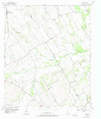
Agricultural life in Central Texas is defined here by the winding course of Richland Creek and its extensive system of Levees. The landscape in the late 1950s is a mix of small crossroads communities and scattered family landmarks. The small settlement of Irene sits in the northwest corner along the Missouri Pacific railroad, while Pelham and Emmett anchor the central and northern plains. This survey documents the rural social fabric through its numerous burial grounds and spiritual centers, such as Salem Cem, Graham Cem, and Antioch Ch. Notably, an Old Railroad Grade traces a path through the southwest, marking the footprint of earlier transit lines that once connected these farming outposts. The network of waterways including White Rock Creek and Ash Creek further emphasizes the hydraulic management required for the region's blackland prairie soils.
Find a feature on this map
31 named features on this map. Tap any name to fly to it.
Don’t see what you’re looking for? This feature index may not catch every label — zoom into the map to look around manually.
Map Details
Editions of this 1957 Irene Map
3 editions found
Other maps of this area

1954 · Dallas
USGS Topo · 1:250,000

1954 · Waco
USGS Topo · 1:250,000

1955 · Waco
USGS Topo · 1:250,000

1956 · Hubbard
USGS Topo · 1:24,000

1956 · Penelope
USGS Topo · 1:24,000

1956 · Dawson
USGS Topo · 1:24,000
1957 · Malone
USGS Topo · 1:24,000

1958 · Dallas
USGS Topo · 1:250,000

1965 · Coolidge
USGS Topo · 1:24,000
1965 · Blooming Grove
USGS Topo · 1:24,000