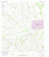
1957 Map of Irene
USGS Topo · Published 1978About this map
Irene and the surrounding prairie lands of the Navarro Co Hill Co line are defined by a complex network of hydrological management and rural settlement patterns. This 1957 survey, updated with 1976 photogrammetric revisions, reveals the transformation of the landscape as Navarro Mills Lake was established. Extensive levees line the banks of Richland Creek and White Rock Creek, indicating significant efforts to control the floodplain for agricultural use. For genealogists, the map is a detailed record of local heritage, pinpointing multiple burial grounds including Salem Cem, Graham Cem, and Pelham Cem. The community of Pelham and the Antioch Ch serve as social anchors in an area where an Old Railroad Grade traces the path of former transit corridors through the drainage basins of Bynum Creek and Ash Creek.
Find a feature on this map
26 named features on this map. Tap any name to fly to it.
Don’t see what you’re looking for? This feature index may not catch every label — zoom into the map to look around manually.
Map Details
Editions of this 1957 Irene Map
3 editions found
Other maps of this area

1954 · Dallas
USGS Topo · 1:250,000

1954 · Waco
USGS Topo · 1:250,000

1955 · Waco
USGS Topo · 1:250,000

1956 · Hubbard
USGS Topo · 1:24,000

1956 · Penelope
USGS Topo · 1:24,000

1956 · Dawson
USGS Topo · 1:24,000

1957 · Irene
USGS Topo · 1:24,000
1957 · Malone
USGS Topo · 1:24,000

1958 · Dallas
USGS Topo · 1:250,000

1965 · Coolidge
USGS Topo · 1:24,000