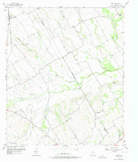
1957 Map of Irene
USGS Topo · Published 1975About this map
The borderlands between Navarro and Hill counties are defined by a complex network of tributaries and protective engineering in this mid-century survey. Major drainage systems like Richland Creek and White Rock Creek dominate the terrain, notably marked by extensive Levee systems designed to manage the bottomlands. The settlement of Irene serves as a northern anchor along the Missouri Pacific railroad, while an Old Railroad Grade to the south traces a superseded transportation path across the prairie. The map reveals a deeply rooted rural community, highlighted by family and community landmarks like Salem Cem, Antioch Ch, and the settlement of Pelham. This 1957 landscape illustrates a late stage of the regional rail-and-creek economy before modern highway development further altered the distribution of small Texas prairie towns like Emmett and Brushie Prairie.
Find a feature on this map
26 named features on this map. Tap any name to fly to it.
Don’t see what you’re looking for? This feature index may not catch every label — zoom into the map to look around manually.
Map Details
Editions of this 1957 Irene Map
3 editions found
Other maps of this area

1954 · Dallas
USGS Topo · 1:250,000

1954 · Waco
USGS Topo · 1:250,000

1955 · Waco
USGS Topo · 1:250,000

1956 · Hubbard
USGS Topo · 1:24,000

1956 · Penelope
USGS Topo · 1:24,000

1956 · Dawson
USGS Topo · 1:24,000

1957 · Irene
USGS Topo · 1:24,000
1957 · Malone
USGS Topo · 1:24,000

1958 · Dallas
USGS Topo · 1:250,000

1965 · Coolidge
USGS Topo · 1:24,000