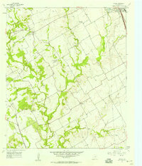
1957 Map of Peoria
USGS Topo · Published 1957About this map
Peoria and Vaughan anchor this mid-century look at the landscape of Hill County, where the transition from traditional farming to modern infrastructure is evident in the presence of the Triplett Ranch Airfield alongside long-established rural institutions. The map documents a shifting educational landscape, specifically marking Union Bluff Sch (Aband) and Culp Sch (Aband) as no longer in use. A network of creeks, including Aquilla Creek, Hackberry Creek, and Cobb Creek, carves through the terrain, dictating the placement of early settlements and family cemeteries like Hickey Cem. Transportation is represented by the heavy-duty Blue Star Memorial Highway and the Missouri Kansas Texas railroad line, while the city boundary of Hillsboro encroaches on the northeastern corner, indicating the growth of the county seat.
Find a feature on this map
23 named features on this map. Tap any name to fly to it.
Don’t see what you’re looking for? This feature index may not catch every label — zoom into the map to look around manually.
Map Details
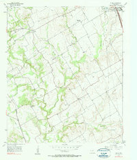
Editions of this 1957 Peoria Map
2 editions found
Other maps of this area

1891 · Cleburne
USGS Topo · 1:125,000

1892 · Waco
USGS Topo · 1:125,000

1894 · Cleburne
USGS Topo · 1:125,000

1920 · Waco
USGS Topo · 1:125,000

1927 · Blum
USGS Topo · 1:62,500

1931 · Whitney
USGS Topo · 1:62,500

1954 · Dallas
USGS Topo · 1:250,000

1954 · Waco
USGS Topo · 1:250,000

1955 · Waco
USGS Topo · 1:250,000

1956 · Abbott
USGS Topo · 1:24,000