
1927 Map of Blum
USGS Topo · Published 1927About this map
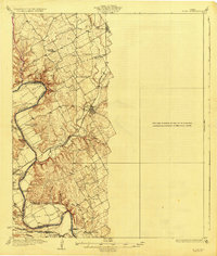
The Brazos River carves a winding path through this 1920s landscape at the junction of Johnson, Bosque, and Hill Counties. Significant river crossings such as Phelps Crossing, Dowell Crossing, and Logwood Crossing highlight the importance of local fords before the widespread construction of highway bridges. The area is anchored by the rail settlements of Blum and Rio Vista along the Gulf Colorado and Santa Fe Railway, while the southern reaches show the Missouri Kansas and Texas line serving Kopperl. The presence of scattered rural education centers like Live Oak School and Greenbrier School illustrates the distributed nature of Texas ranching and farming communities during this era. High ground is marked by features like Robison Bluff and Powell dale Mtn, overlooking the expansive Steiner Valley.
Find a feature on this map
33 named features on this map. Tap any name to fly to it.
Don’t see what you’re looking for? This feature index may not catch every label — zoom into the map to look around manually.
Map Details
Editions of this 1927 Blum Map
2 editions found
Other maps of this area

1888 · Meridian
USGS Topo · 1:125,000

1889 · Granbury
USGS Topo · 1:125,000

1891 · Cleburne
USGS Topo · 1:125,000

1892 · Waco
USGS Topo · 1:125,000

1894 · Meridian
USGS Topo · 1:125,000

1894 · Cleburne
USGS Topo · 1:125,000

1920 · Waco
USGS Topo · 1:125,000

1924 · Cleburne 3-B
USGS Topo · 1:48,000

1924 · Waco 2-b
USGS Topo · 1:48,000

1924 · Cleburne 3-C
USGS Topo · 1:48,000