
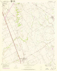
1956 Map of Abbott
USGS Topo · Published 1957About this map
The Missouri Kansas Texas Railroad corridor serves as the primary axis for Hill County’s rural development in the mid-1950s, anchoring the small agricultural hubs of Abbott and Bynum. The landscape is defined by the drainage systems of Cobb Creek and Brookeen Creek, which cut through the blackland prairie soil. Large-scale infrastructure projects are evident in the path of the Blue Star Memorial Highway and various pipelines that traverse the region. Local history is deeply rooted in the land, as seen in the several rural burial grounds such as Jessie Cem, Abbott Cem, and Bell Springs Cem. The prevalence of Caliche Pits throughout the area indicates the local economic reliance on limestone road-building materials during this period of mid-century expansion.
Find a feature on this map
26 named features on this map. Tap any name to fly to it.
Don’t see what you’re looking for? This feature index may not catch every label — zoom into the map to look around manually.
Map Details
Editions of this 1956 Abbott Map
2 editions found
Other maps of this area

1891 · Cleburne
USGS Topo · 1:125,000

1892 · Waco
USGS Topo · 1:125,000

1894 · Cleburne
USGS Topo · 1:125,000

1920 · Waco
USGS Topo · 1:125,000

1954 · Dallas
USGS Topo · 1:250,000

1954 · Waco
USGS Topo · 1:250,000

1955 · Waco
USGS Topo · 1:250,000

1956 · Penelope
USGS Topo · 1:24,000

1956 · West
USGS Topo · 1:24,000
1957 · Aquilla
USGS Topo · 1:24,000