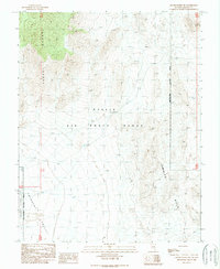
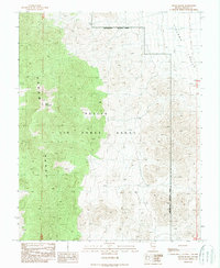
1989 Map of Groom Range SW
USGS Topo · Published 1989About this map
Nellis Air Force Range dominates this landscape, reflecting the heavy military presence in the High Desert during the late twentieth century. Located in Lincoln County, the map provides a look at the transition between the basin floor of Emigrant Valley and the rising elevations of the Groom Range to the northwest. The presence of the Nevada Test Site Restricted Access Area along the western edge highlights the strategic and classified nature of this terrain during the Cold War era. This provisional survey captures a vast expanse of undeveloped land, where the topography is defined by the sharp, arid peaks of the Jumbled Hills. The lack of civil infrastructure underscores the isolation of these military-controlled zones in the Nevada desert.
Find a feature on this map
9 named features on this map. Tap any name to fly to it.
Don’t see what you’re looking for? This feature index may not catch every label — zoom into the map to look around manually.
Map Details
Editions of this 1989 Groom Range SW Map
This is the sole edition of this map. No revisions or reprints were ever made.
Other maps of this area

1942 · Emigrant Valley
USGS Topo · 1:125,000

1952 · Papoose Lake
USGS Topo · 1:62,500

1952 · Groom Mine
USGS Topo · 1:62,500

1954 · Caliente
USGS Topo · 1:250,000

1959 · Caliente
USGS Topo · 1:250,000
1983 · Groom Range SE
USGS Topo · 1:24,000
1983 · Groom Range NE
USGS Topo · 1:24,000
1983 · Fallout Hills NE
USGS Topo · 1:24,000

1985 · Pahranagat Range
USGS Topo · 1:100,000
1989 · Groom Range
USGS Topo · 1:24,000