
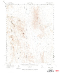
1952 Map of Papoose Lake
USGS Topo · Published 1958About this map
The Las Vegas Bombing and Gunnery Range dominates this mid-century landscape of the Nevada desert, where military activity and natural basins converge. Mapping efforts by the Army Map Service reveal a territory undergoing intense administrative transformation, marked by the proximity of the Nevada Proving Grounds and the sprawling Desert Game Range. The terrain is defined by its arid dry lakes and prominent ridges, with the Papoose Lake bed sitting central to the Papoose Range.
Find a feature on this map
9 named features on this map. Tap any name to fly to it.
Don’t see what you’re looking for? This feature index may not catch every label — zoom into the map to look around manually.
Map Details
Editions of this 1952 Papoose Lake Map
2 editions found
Other maps of this area

1907 · Las Vegas
USGS Topo · 1:250,000

1908 · Kawich
USGS Topo · 1:250,000

1908 · Furnace Creek
USGS Topo · 1:250,000

1908 · Las Vegas
USGS Topo · 1:250,000

1910 · Furnace Creek
USGS Topo · 1:250,000

1942 · Emigrant Valley
USGS Topo · 1:125,000

1942 · Indian Spring
USGS Topo · 1:125,000

1942 · Wheelbarrow Peak
USGS Topo · 1:125,000

1942 · Skull Mountain
USGS Topo · 1:125,000

1948 · Death Valley
USGS Topo · 1:250,000