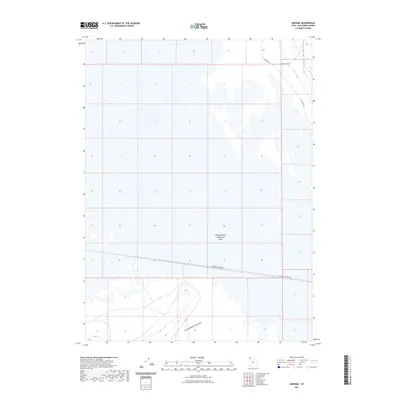
2023 Map of Groome
USGS Topo · Published 2023About this map
The Newfoundland Evaporation Basin dominates this landscape in Box Elder County, showing the specialized industrial land use characteristic of the Great Salt Lake Desert. The basin floor is bordered by the dramatic rises of the Newfoundland Mountains to the south and the Hogup Mountains to the northeast. Transportation through this arid region is defined by functional access routes, including Railroad Siding Rd which runs parallel to the rail corridor crossing the basin, and Indian Cave Acc near the northern mountains. This modern survey illustrates the intersection of vast geological formations and the human infrastructure required to navigate and utilize the salt flats.
Find a feature on this map
6 named features on this map. Tap any name to fly to it.
Don’t see what you’re looking for? This feature index may not catch every label — zoom into the map to look around manually.
Map Details
Editions of this 2023 Groome Map
This is the sole edition of this map. No revisions or reprints were ever made.
Other maps of this area

1954 · Brigham City
USGS Topo · 1:250,000

1958 · Brigham City
USGS Topo · 1:250,000

1962 · Brigham City
USGS Topo · 1:250,000

1983 · Desert Peak
USGS Topo · 1:24,000

1983 · Lemay
USGS Topo · 1:24,000

1983 · Round Mountain NW
USGS Topo · 1:24,000

1983 · Terrace Mountain East
USGS Topo · 1:24,000

1983 · Sheep Mountain
USGS Topo · 1:24,000

1983 · Groome
USGS Topo · 1:24,000
1983 · Meadow Spring
USGS Topo · 1:24,000