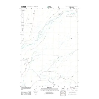
2012 Map of Gros Ventre Junction
USGS Topo · Published 2012About this map
The Gros Ventre River carves a complex, braided path across this landscape, defining the northern geography near the settlement of Kelly. This 2012 survey illustrates a region where aviation infrastructure at the Jackson Hole Airport exists alongside significant conservation and agricultural efforts. To the south, the Jackson National Fish Hatchery and Peterson Springs highlight the importance of the local water network, including Flat Creek and Nowlin Creek.
Find a feature on this map
43 named features on this map. Tap any name to fly to it.
Don’t see what you’re looking for? This feature index may not catch every label — zoom into the map to look around manually.
Map Details
Editions of this 2012 Gros Ventre Junction Map
This is the sole edition of this map. No revisions or reprints were ever made.
Other maps of this area

1899 · Grand Teton
USGS Topo · 1:125,000

1901 · Grand Teton
USGS Topo · 1:125,000

1931 · Jackson
USGS Topo · 1:125,000

1935 · Jackson
USGS Topo · 1:125,000

1955 · Driggs
USGS Topo · 1:250,000

1958 · Driggs
USGS Topo · 1:250,000

1962 · Driggs
USGS Topo · 1:250,000

1963 · Jackson
USGS Topo · 1:24,000
1965 · Turquoise Lake
USGS Topo · 1:24,000
1965 · Cache Creek
USGS Topo · 1:24,000