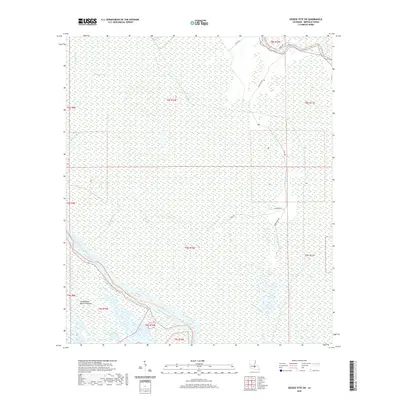
2020 Map of Grosse Tete SW
USGS Topo · Published 2020About this map
Atchafalaya Basin Floodway dominates the landscape of Iberville Parish in this contemporary survey, revealing a complex hydrological system of bayous and wetlands. The intricate network of waterways, including Bayou Maringouin, Bayou Grosse Tete, and Bayou Choctaw, illustrates the natural drainage patterns of this low-lying region. Smaller features like Halfway Lake and the Trinity Canal punctuate the vast wetland environment. Human infrastructure is sparsely overlaid upon this aquatic terrain, with secondary routes such as State Rte 386, Alligator Rd, and McBay Rd providing access through the basin. This map serves as a detailed record of the shifting water levels and sediment management areas in south Louisiana, where the land and water are perpetually intertwined.
Find a feature on this map
25 named features on this map. Tap any name to fly to it.
Don’t see what you’re looking for? This feature index may not catch every label — zoom into the map to look around manually.
Map Details
Editions of this 2020 Grosse Tete SW Map
This is the sole edition of this map. No revisions or reprints were ever made.
Other maps of this area

1935 · Osca Bayou
USGS Topo · 1:62,500

1935 · Chicot Lake
USGS Topo · 1:62,500

1940 · Grosse Tete
USGS Topo · 1:62,500

1941 · Loreauville
USGS Topo · 1:62,500

1953 · Crescent
USGS Topo · 1:24,000

1953 · Cow Bayou
USGS Topo · 1:24,000

1953 · Lobdell
USGS Topo · 1:24,000

1953 · Pigeon Bay
USGS Topo · 1:24,000

1953 · Maringouin
USGS Topo · 1:24,000

1953 · Addis
USGS Topo · 1:24,000