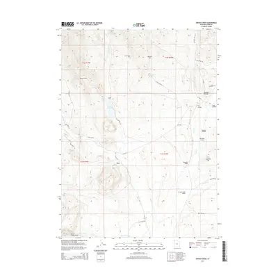
2014 Map of Grouse Creek
USGS Topo · Published 2014About this map
Grouse Creek anchors this high-desert basin in Box Elder County, where the settlement pattern follows the life-giving drainages of Grouse Cr and Etna Cr. The landscape is defined by its ranching heritage, clearly visible through established family landmarks like Kimber Ranch and the isolated Kimber Ranch Burial site. To the west, the community of Etna sits near the Etna Reservoir, a vital water resource in a region carved by seasonal flows and deep canyons. The southern reach of the survey reveals the distinct geographical feature known as the Narrows of Dairy Valley, where Dairy Valley Cr cuts through the rising terrain. Transportation routes like Death Valley Rd and Ingham Pass Rd suggest the historic movement of people and livestock across Grouse Creek Valley, connecting the scattered homesteads and natural springs that sustained this remote corner of Utah.
Find a feature on this map
42 named features on this map. Tap any name to fly to it.
Don’t see what you’re looking for? This feature index may not catch every label — zoom into the map to look around manually.
Map Details
Editions of this 2014 Grouse Creek Map
This is the sole edition of this map. No revisions or reprints were ever made.
Other maps of this area

1954 · Brigham City
USGS Topo · 1:250,000

1955 · Wells
USGS Topo · 1:250,000

1958 · Wells
USGS Topo · 1:250,000

1958 · Brigham City
USGS Topo · 1:250,000

1959 · Cotton Thomas Basin
USGS Topo · 1:62,500

1961 · Wells
USGS Topo · 1:250,000

1961 · Goose Creek
USGS Topo · 1:62,500

1961 · Dairy Valley
USGS Topo · 1:62,500

1962 · Brigham City
USGS Topo · 1:250,000
1971 · Toms Cabin Spring
USGS Topo · 1:24,000