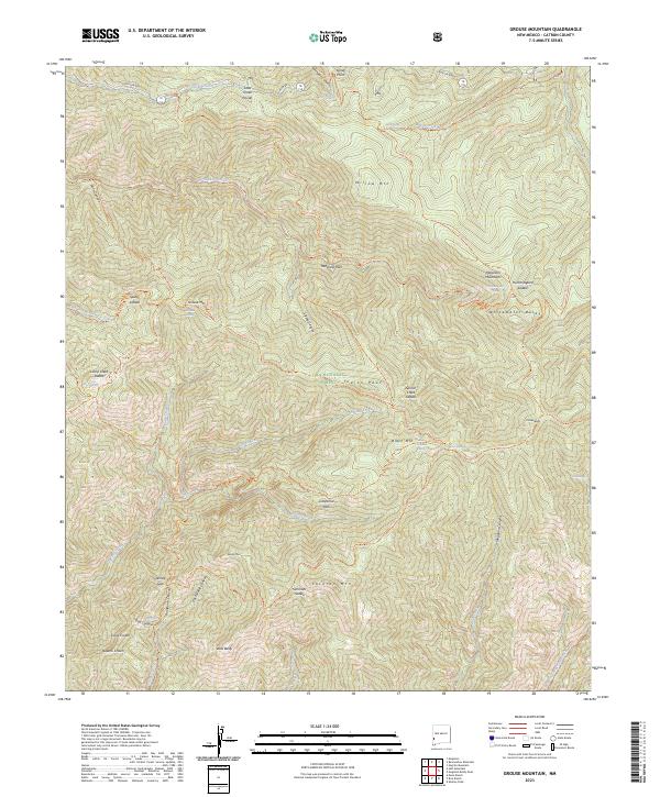
2023 Map of Grouse Mountain
USGS Topo · Published 2023About this map
The Mogollon Mountains dominate this high-elevation landscape within the Gila Wilderness of the Gila National Forest. This modern record of the terrain shows a vast network of drainages and peaks, centered on high points such as Whitewater Baldy and West Baldy. The map documents a primitive transportation system composed of forest roads and hiking trails that follow natural contours, such as the Crest Trl and Whitewater Trl. Numerous named saddles and parks, including Redstone Park and California Park, provide distinct navigational markers between the steep canyons of Winn Canyon and Packsaddle Canyon. Many springs, such as Hummingbird Spring and Black Mountain Spring, are identified across the quadrangle, highlighting the critical water sources in this high-country environment. The naming conventions, like Kings Crown and Queens Crown, reflect the local history and folklore of the New Mexico wilderness.
Find a feature on this map
65 named features on this map. Tap any name to fly to it.
Don’t see what you’re looking for? This feature index may not catch every label — zoom into the map to look around manually.
Map Details
Editions of this 2023 Grouse Mountain Map
This is the sole edition of this map. No revisions or reprints were ever made.
Other maps of this area

1910 · Mogollon
USGS Topo · 1:125,000

1912 · Mogollon
USGS Topo · 1:125,000

1954 · Clifton
USGS Topo · 1:250,000

1957 · Clifton
USGS Topo · 1:250,000

1958 · Clifton
USGS Topo · 1:250,000

1962 · Clifton
USGS Topo · 1:250,000

1963 · Bearwallow Mountain
USGS Topo · 1:24,000

1963 · Negrito Mountain
USGS Topo · 1:24,000
1963 · Mogollon
USGS Topo · 1:24,000
1965 · Rice Ranch
USGS Topo · 1:24,000