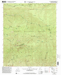
1999 Map of Grouse Mountain
USGS Topo · Published 2002About this map
Gila Wilderness and the Gila National Forest define this high-altitude landscape within the Mogollon Mountains. The terrain is marked by sharp elevation changes, peaking at Whitewater Baldy and Sacaton Mountain. Evidence of early surveying and resource management is visible through the presence of several mineral monuments, including Usmm No 1, Usmm No 2, and Usmm No 3. These markers, alongside remote outposts like Spruce Creek Cabin and Golden Link Cabin, point to the area's history of mineral exploration and forest service oversight.
Find a feature on this map
69 named features on this map. Tap any name to fly to it.
Don’t see what you’re looking for? This feature index may not catch every label — zoom into the map to look around manually.
Map Details
Editions of this 1999 Grouse Mountain Map
This is the sole edition of this map. No revisions or reprints were ever made.
Other maps of this area

1910 · Mogollon
USGS Topo · 1:125,000

1912 · Mogollon
USGS Topo · 1:125,000

1954 · Clifton
USGS Topo · 1:250,000

1957 · Clifton
USGS Topo · 1:250,000

1958 · Clifton
USGS Topo · 1:250,000

1962 · Clifton
USGS Topo · 1:250,000

1963 · Bearwallow Mountain
USGS Topo · 1:24,000

1963 · Negrito Mountain
USGS Topo · 1:24,000
1963 · Mogollon
USGS Topo · 1:24,000
1965 · Rice Ranch
USGS Topo · 1:24,000