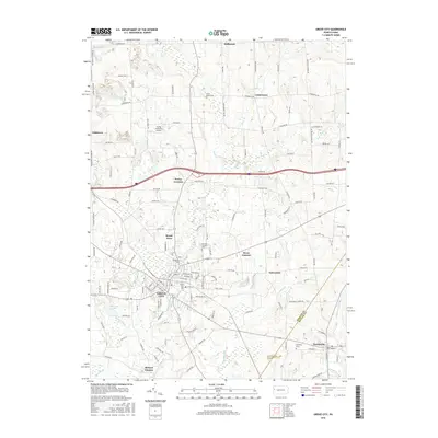
2016 Map of Grove City
USGS Topo · Published 2016About this map
Grove City anchors this 2016 survey, where the campus of Grove City Coll stands near the confluence of Wolf Creek and Barmore Run. This landscape in the Mercer and Butler County borderlands reveals a dense network of crossroads settlements and ancestral sites. To the north, Millbrook and Centertown remain connected by historic routes like Scrubgrass Rd, while the Flying M Ranch Airport occupies the high ground near Irishtown. Numerous burial grounds, including Union Home Cem and Woodland Cem, provide significant touchpoints for genealogical research. The mapping of Barmore Lake and the drainage patterns of Swamp Run and Black Run illustrate the hydrology that historically influenced the development of surrounding hamlets like Perrys Corners and Kerrs Corners.
Find a feature on this map
119 named features on this map. Tap any name to fly to it.
Don’t see what you’re looking for? This feature index may not catch every label — zoom into the map to look around manually.
Map Details
Editions of this 2016 Grove City Map
This is the sole edition of this map. No revisions or reprints were ever made.
Other maps of this area

1909 · Franklin
USGS Topo · 1:62,500

1910 · Hilliards
USGS Topo · 1:62,500

1911 · Franklin
USGS Topo · 1:62,500

1911 · Stoneboro
USGS Topo · 1:62,500

1912 · Hilliards
USGS Topo · 1:62,500

1913 · Stoneboro
USGS Topo · 1:62,500

1913 · Mercer
USGS Topo · 1:62,500

1939 · Mercer
USGS Topo · 1:62,500

1943 · Mercer
USGS Topo · 1:62,500

1943 · Stoneboro
USGS Topo · 1:62,500
Featured Places
- Grove City, PA
- Harrisville, PA
- Jackson Township, PA
- Irishtown, Findley Township
- Broad Acres, Pine Township