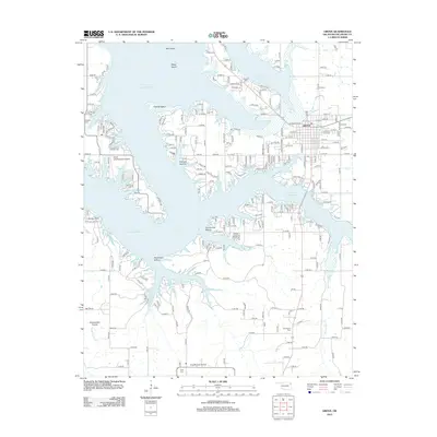
2012 Map of Grove
USGS Topo · Published 2012About this map
Grove serves as the primary hub on this 2012 survey, situated along the intricate eastern shoreline of Grand Lake O' the Cherokees. The map reveals a complex interface of land and water, where finger-like peninsulas and deep inlets create a distinctive geography defined by features like Patricia Island and Flatrock Hollow. Beyond the modern residential developments and the Grand Lake Regional Airport, the landscape retains deep historical markers. Scattered burial grounds such as Zena Cem and Tauuneacie Cem provide critical touchstones for genealogists, while the transition from the wooded hollows to open areas like Sweetwater Prairie and Courthouse Prairie illustrates the varied Oklahoma terrain that has shaped local settlement patterns for generations.
Find a feature on this map
99 named features on this map. Tap any name to fly to it.
Don’t see what you’re looking for? This feature index may not catch every label — zoom into the map to look around manually.
Map Details
Editions of this 2012 Grove Map
This is the sole edition of this map. No revisions or reprints were ever made.
Other maps of this area
1899 · Siloam Springs
USGS Topo · 1:125,000
1903 · Siloam Springs
USGS Topo · 1:125,000
1904 · Siloam Springs
USGS Topo · 1:125,000
1907 · Wyandotte
USGS Topo · 1:125,000
1909 · Wyandotte
USGS Topo · 1:125,000

1954 · Tulsa
USGS Topo · 1:250,000
1958 · Tulsa
USGS Topo · 1:250,000
1963 · Tulsa
USGS Topo · 1:250,000
1964 · Cayuga
USGS Topo · 1:24,000
1964 · Dodge
USGS Topo · 1:24,000