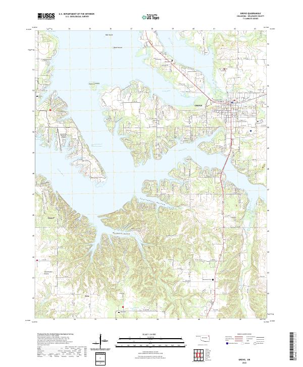
2022 Map of Grove
USGS Topo · Published 2022About this map
The shoreline of Grand Lake O' The Cherokees dominates this landscape, where the waters of the Neosho River meet numerous timbered inlets and coves. The town of Grove sits as the primary hub on the eastern shore, showing a developed street grid that contrasts with the surrounding agricultural and wooded terrain. Significant genealogical markers are scattered throughout the region, including Buzzard Cem near the northern reaches and Taueneacie Cem to the south, providing critical points of reference for local family history research.
Find a feature on this map
162 named features on this map. Tap any name to fly to it.
Don’t see what you’re looking for? This feature index may not catch every label — zoom into the map to look around manually.
Map Details
Editions of this 2022 Grove Map
This is the sole edition of this map. No revisions or reprints were ever made.
Other maps of this area

1899 · Siloam Springs
USGS Topo · 1:125,000

1903 · Siloam Springs
USGS Topo · 1:125,000

1904 · Siloam Springs
USGS Topo · 1:125,000

1907 · Wyandotte
USGS Topo · 1:125,000

1909 · Wyandotte
USGS Topo · 1:125,000

1954 · Tulsa
USGS Topo · 1:250,000

1958 · Tulsa
USGS Topo · 1:250,000

1963 · Tulsa
USGS Topo · 1:250,000
1964 · Cayuga
USGS Topo · 1:24,000

1964 · Dodge
USGS Topo · 1:24,000