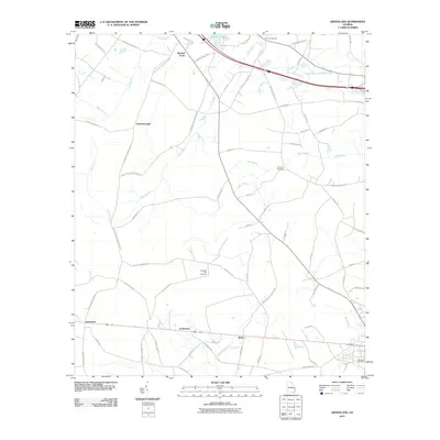
2011 Map of Groveland
USGS Topo · Published 2011About this map
Groveland and Reka anchor the southern portion of this landscape, situated along the east-west transit corridor that passes through Southward. The terrain is defined by a complex drainage network where Luke Swamp and its various branches, including Ash Branch and Futch Branch, weave between rural holdings. These watercourses likely dictated early road placement and settlement patterns, seen in the winding paths of Old Donaldson School Rd and Backwood Rd.
Find a feature on this map
66 named features on this map. Tap any name to fly to it.
Don’t see what you’re looking for? This feature index may not catch every label — zoom into the map to look around manually.
Map Details
Editions of this 2011 Groveland Map
This is the sole edition of this map. No revisions or reprints were ever made.
Other maps of this area

1919 · Claxton
USGS Topo · 1:62,500

1920 · Pembroke
USGS Topo · 1:62,500

1920 · Statesboro
USGS Topo · 1:62,500

1921 · Brooklet
USGS Topo · 1:62,500

1943 · Brooklet
USGS Topo · 1:62,500

1943 · Statesboro
USGS Topo · 1:62,500

1944 · Claxton
USGS Topo · 1:62,500

1947 · Savannah
USGS Topo · 1:250,000

1948 · Savannah
USGS Topo · 1:250,000

1948 · Pembroke
USGS Topo · 1:62,500