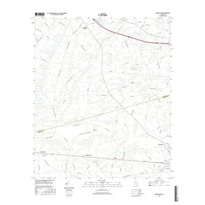
2017 Map of Groveland
USGS Topo · Published 2017About this map
Pembroke serves as a primary hub in this coastal plain landscape, situated at the junction of rail and highway corridors that define the region's movement. The map captures the interface between Bulloch and Bryan counties, where the land is characterized by extensive wetlands and drainage systems such as Luke Swamp, Ash Br, and Futch Br. These waterways thread through a network of small, scattered communities like Reka, Southward, and Mitchell Forks. A high concentration of family and community burial grounds, including Beautiful Zion Cem, Red Hill Cem, and Lawrence Cem, provides significant points of interest for genealogists tracing local lineages. The presence of features like Simmons Pond and Bulloch Bay highlights the low-lying, water-dependent geography that has historically shaped agricultural and residential patterns in this part of Georgia.
Find a feature on this map
100 named features on this map. Tap any name to fly to it.
Don’t see what you’re looking for? This feature index may not catch every label — zoom into the map to look around manually.
Map Details
Editions of this 2017 Groveland Map
This is the sole edition of this map. No revisions or reprints were ever made.
Other maps of this area

1919 · Claxton
USGS Topo · 1:62,500

1920 · Pembroke
USGS Topo · 1:62,500

1920 · Statesboro
USGS Topo · 1:62,500

1921 · Brooklet
USGS Topo · 1:62,500

1943 · Brooklet
USGS Topo · 1:62,500

1943 · Statesboro
USGS Topo · 1:62,500

1944 · Claxton
USGS Topo · 1:62,500

1947 · Savannah
USGS Topo · 1:250,000

1948 · Savannah
USGS Topo · 1:250,000

1948 · Pembroke
USGS Topo · 1:62,500