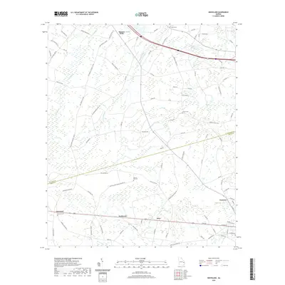
2020 Map of Groveland
USGS Topo · Published 2020About this map
The town of Pembroke and the neighboring community of Groveland anchor this landscape along the border of Bulloch and Bryan counties. This modern survey illustrates the persistent rural settlement patterns of the Georgia coastal plain, where small hamlets like Southward, Reka, and Mitchell Forks are connected by a dense network of family-named roads such as Horace Mitchell Rd and Ju Williams Ln. The terrain is defined by a complex system of bay swamps and slow-moving branches, including Bryan Bay, Bulloch Bay, and Boggy Bay. Local history is preserved in several rural burial grounds, notably Beautiful Zion Cem and Red Hill Cem, which sit alongside established routes like Red Hill Church Rd. The map provides a clear view of the drainage patterns through Luke Swamp and Mill Cr, highlighting the intersection of human settlement with the region's unique wetland geography.
Find a feature on this map
90 named features on this map. Tap any name to fly to it.
Don’t see what you’re looking for? This feature index may not catch every label — zoom into the map to look around manually.
Map Details
Editions of this 2020 Groveland Map
This is the sole edition of this map. No revisions or reprints were ever made.
Other maps of this area

1919 · Claxton
USGS Topo · 1:62,500

1920 · Pembroke
USGS Topo · 1:62,500

1920 · Statesboro
USGS Topo · 1:62,500

1921 · Brooklet
USGS Topo · 1:62,500

1943 · Brooklet
USGS Topo · 1:62,500

1943 · Statesboro
USGS Topo · 1:62,500

1944 · Claxton
USGS Topo · 1:62,500

1947 · Savannah
USGS Topo · 1:250,000

1948 · Savannah
USGS Topo · 1:250,000

1948 · Pembroke
USGS Topo · 1:62,500