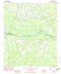
1982 Map of Grover
USGS Topo · Published 1983About this map
The Edisto River meanders across this Lowcountry landscape, defining the boundary between Dorchester and Colleton counties. This 1980s-era survey reveals a community deeply rooted in its local landmarks, with numerous family cemeteries like Utsey Cem, Seigler Cem, and Hiott Cem scattered throughout the rural interior. The small settlement of Grover serves as a primary point of reference in the north, while the crossing at Canadys and the adjacent Colleton State Park anchor the southwestern reach of the river.
Find a feature on this map
27 named features on this map. Tap any name to fly to it.
Don’t see what you’re looking for? This feature index may not catch every label — zoom into the map to look around manually.
Map Details
Editions of this 1982 Grover Map
This is the sole edition of this map. No revisions or reprints were ever made.
Other maps of this area

1918 · Walterboro
USGS Topo · 1:62,500

1918 · Cottageville
USGS Topo · 1:62,500

1919 · Ridgeville
USGS Topo · 1:48,000

1920 · Ridgeville
USGS Topo · 1:62,500

1920 · St. George
USGS Topo · 1:48,000

1921 · St. George
USGS Topo · 1:62,500

1943 · Cottageville
USGS Topo · 1:62,500

1943 · Orangeburg
USGS Topo · 1:125,000

1943 · Walterboro
USGS Topo · 1:62,500

1943 · Ridgeville
USGS Topo · 1:62,500