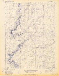
1972 Map of Grover NE
USGS Topo · Published 1974About this map
Sidney Draw winds through this Weld County landscape, where the high plains terrain is defined by dramatic escarpments and shifting elevations. The 1970s rural character of the region is evident in the sparse but significant cultural markers, such as the Zion Ch and a nearby Cem, which serve as focal points for the local agricultural community. Modern infrastructure is represented by a Substa and the prominent Radio Tower (KNEB-AM-FM), reflecting the area's mid-century communication and utility expansion. The map provides a detailed view of the section lines and township boundaries, specifically T. 12 N. T. 11 N., which were critical for local land ownership and navigation during this period of development in northeastern Colorado.
Find a feature on this map
7 named features on this map. Tap any name to fly to it.
Don’t see what you’re looking for? This feature index may not catch every label — zoom into the map to look around manually.
Map Details
Editions of this 1972 Grover NE Map
3 editions found
Other maps of this area

1954 · Sterling
USGS Topo · 1:250,000

1954 · Scottsbluff
USGS Topo · 1:250,000

1954 · Cheyenne
USGS Topo · 1:250,000

1954 · Greeley
USGS Topo · 1:250,000

1957 · Greeley
USGS Topo · 1:250,000

1958 · Cheyenne
USGS Topo · 1:250,000

1958 · Greeley
USGS Topo · 1:250,000

1958 · Scottsbluff
USGS Topo · 1:250,000

1958 · Sterling
USGS Topo · 1:250,000

1961 · Greeley
USGS Topo · 1:250,000