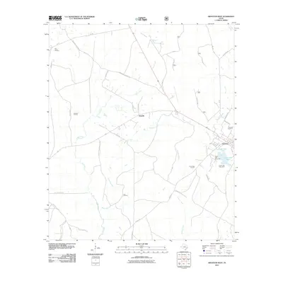
2010 Map of Groveton West
USGS Topo · Published 2010About this map
The timber and creek lands of Trinity County are anchored by Groveton and the nearby settlement of Westville. This landscape is defined by the drainage networks of Kickapoo Creek and Caney Creek, which feed into the managed waters of Upper Lake Avery and Lower Lake Avery. These reservoirs are secured by the Upper Lake Avery Dam and Lower Lake Avery Dam, reflecting modern water management in this historically wood-driven region.
Find a feature on this map
39 named features on this map. Tap any name to fly to it.
Don’t see what you’re looking for? This feature index may not catch every label — zoom into the map to look around manually.
Map Details
Editions of this 2010 Groveton West Map
This is the sole edition of this map. No revisions or reprints were ever made.
Other maps of this area

1953 · Palestine
USGS Topo · 1:250,000

1954 · Beaumont
USGS Topo · 1:250,000

1957 · Beaumont
USGS Topo · 1:250,000

1957 · Palestine
USGS Topo · 1:250,000

1960 · Colita
USGS Topo · 1:24,000

1960 · Trinity East
USGS Topo · 1:24,000

1962 · Glendale
USGS Topo · 1:24,000

1963 · Crecy
USGS Topo · 1:24,000

1963 · Groveton West
USGS Topo · 1:24,000
1963 · Pennington
USGS Topo · 1:24,000