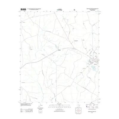
2013 Map of Groveton West
USGS Topo · Published 2013About this map
Groveton and the adjacent community of Westville serve as the primary hubs of this Trinity County landscape, situated amid a complex network of creeks and timberlands. The town layout of Groveton is clearly defined, with streets such as Martin Luther King Dr and Lakeview Dr bordering Upper Lake Avery and Lower Lake Avery. This 2013 survey illustrates how modern infrastructure like the Groveton-Trinity County Airport integrates with the region's older rural character, evidenced by numerous family-named landmarks and remote burial grounds.
Find a feature on this map
55 named features on this map. Tap any name to fly to it.
Don’t see what you’re looking for? This feature index may not catch every label — zoom into the map to look around manually.
Map Details
Editions of this 2013 Groveton West Map
This is the sole edition of this map. No revisions or reprints were ever made.
Other maps of this area

1953 · Palestine
USGS Topo · 1:250,000

1954 · Beaumont
USGS Topo · 1:250,000

1957 · Beaumont
USGS Topo · 1:250,000

1957 · Palestine
USGS Topo · 1:250,000
1960 · Colita
USGS Topo · 1:24,000
1960 · Trinity East
USGS Topo · 1:24,000
1962 · Glendale
USGS Topo · 1:24,000
1963 · Crecy
USGS Topo · 1:24,000
1963 · Groveton West
USGS Topo · 1:24,000
1963 · Pennington
USGS Topo · 1:24,000