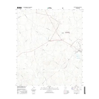
2016 Map of Groveton West
USGS Topo · Published 2016About this map
Groveton and the adjacent settlement of Westville anchor the eastern landscape of this survey, where the Piney Woods meets the edge of the Davy Crockett National Forest. The geography is defined by a dense network of country roads and creek drainages, including Kickapoo Cr and White Oak Cr, which flow through the timberlands south of the Groveton- Trinity County Airport.
Find a feature on this map
45 named features on this map. Tap any name to fly to it.
Don’t see what you’re looking for? This feature index may not catch every label — zoom into the map to look around manually.
Map Details
Editions of this 2016 Groveton West Map
This is the sole edition of this map. No revisions or reprints were ever made.
Other maps of this area

1953 · Palestine
USGS Topo · 1:250,000

1954 · Beaumont
USGS Topo · 1:250,000

1957 · Beaumont
USGS Topo · 1:250,000

1957 · Palestine
USGS Topo · 1:250,000
1960 · Colita
USGS Topo · 1:24,000
1960 · Trinity East
USGS Topo · 1:24,000
1962 · Glendale
USGS Topo · 1:24,000
1963 · Crecy
USGS Topo · 1:24,000
1963 · Groveton West
USGS Topo · 1:24,000
1963 · Pennington
USGS Topo · 1:24,000