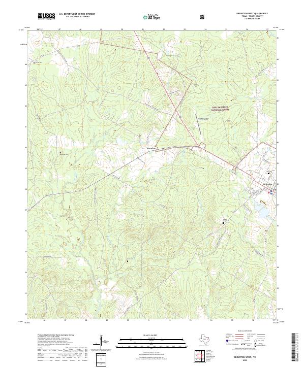
2022 Map of Groveton West
USGS Topo · Published 2022About this map
The Davy Crockett National Forest dominates the landscape of East Texas in this 2022 survey, providing a detailed look at the timberlands and rural networks surrounding the county seat. The town of Groveton sits on the eastern edge of the quadrangle, with its residential streets transitioning into the forest via routes like Lumber Company RD. To the west, the settlement of Westville serves as a central point for numerous timber and hunting roads, including the Dean Creek Hunting Club RD and Pnth Creek Hunting Club RD. Genealogists will find a significant number of family and community burial grounds documented across the area, from Ellis Prairie Cem in the northwest to Parker Ridge Cem and Glenwood Cem. The winding paths of Caney Creek and White Oak Cr carve through the wooded terrain, illustrating the intricate drainage patterns that define this Trinity County geography.
Find a feature on this map
45 named features on this map. Tap any name to fly to it.
Don’t see what you’re looking for? This feature index may not catch every label — zoom into the map to look around manually.
Map Details
Editions of this 2022 Groveton West Map
This is the sole edition of this map. No revisions or reprints were ever made.
Other maps of this area

1953 · Palestine
USGS Topo · 1:250,000

1954 · Beaumont
USGS Topo · 1:250,000

1957 · Beaumont
USGS Topo · 1:250,000

1957 · Palestine
USGS Topo · 1:250,000

1960 · Colita
USGS Topo · 1:24,000

1960 · Trinity East
USGS Topo · 1:24,000

1962 · Glendale
USGS Topo · 1:24,000

1963 · Crecy
USGS Topo · 1:24,000

1963 · Groveton West
USGS Topo · 1:24,000
1963 · Pennington
USGS Topo · 1:24,000