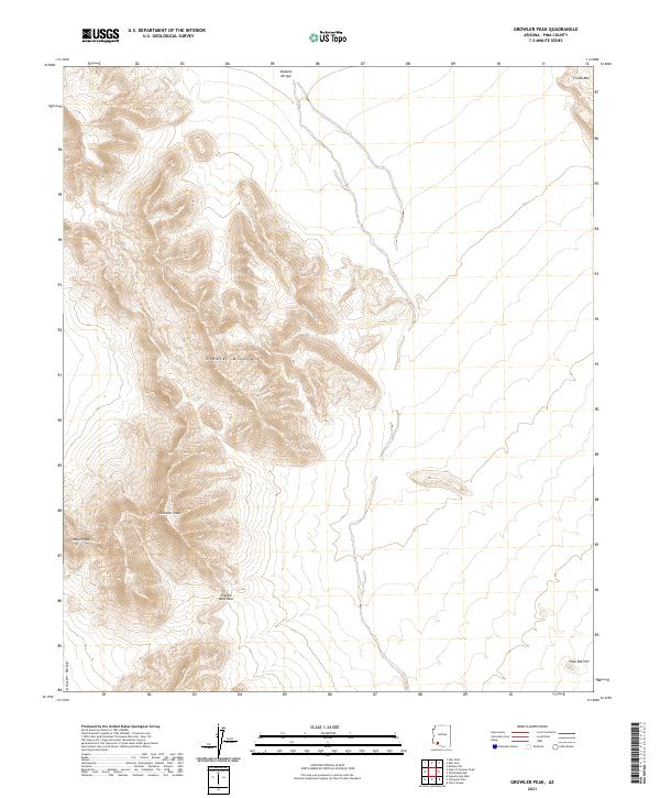
2021 Map of Growler Peak
USGS Topo · Published 2021About this map
Growler Peak dominates this arid landscape in Pima County, serving as a primary landmark within the greater Growler Mountains. This 2021 survey illustrates a region defined by dramatic topographic relief and seasonal drainage systems, notably Daniels Arroyo which cuts through the northern reaches of the quadrangle. The map captures the natural corridor of Charlie Bell Pass, a significant geographic notch between the peaks that has historically facilitated movement through this desert terrain. To the west, the land descends into the broad expanse of Growler Valley, while isolated elevations like Sheep Peak, Childs Mtn, and Pack Rat Hill provide distinct navigational points. The survey provides a clear record of the Public Land Survey System grid, including the intersection of t11s r8w and t12s r7w, illustrating how modern administrative boundaries are laid over this ancient geological formation.
Find a feature on this map
12 named features on this map. Tap any name to fly to it.
Don’t see what you’re looking for? This feature index may not catch every label — zoom into the map to look around manually.
Map Details
Editions of this 2021 Growler Peak Map
This is the sole edition of this map. No revisions or reprints were ever made.
Other maps of this area

1932 · Ajo
USGS Topo · 1:62,500

1934 · Ajo
USGS Topo · 1:62,500

1953 · Ajo
USGS Topo · 1:250,000

1957 · Ajo
USGS Topo · 1:250,000

1958 · Ajo
USGS Topo · 1:250,000

1958 · Midway
USGS Topo · 1:62,500

1962 · Ajo
USGS Topo · 1:250,000

1963 · Ajo
USGS Topo · 1:250,000

1963 · Ajo
USGS Topo · 1:62,500

1964 · Growler Peak
USGS Topo · 1:62,500