
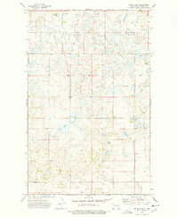
1974 Map of Grubb Lake
USGS Topo · Published 1977About this map
Leaf Mountain and the Foothill terrain dominate the northern reaches of this Burke County landscape, where the prairie is defined by a dense network of glacial potholes and small lakes. This mid-1970s survey captures the rural character of Cleary and Colville townships, showing a region where land use is dictated by the irregular topography of the Missouri Coteau. The distribution of water bodies like Grubb Lake, Muskie Lake, and Smishek Lake illustrates the natural drainage patterns of this upland area. Evidence of agricultural infrastructure and regional development is sparse but specific, noted by features such as a Storage Bin and a Radio Tower. The inclusion of a Drill Hole reflects the period's geological exploration, while the presence of Fish Lake and Harms Lake highlights the importance of these perennial water sources in an otherwise high-elevation prairie environment.
Find a feature on this map
12 named features on this map. Tap any name to fly to it.
Don’t see what you’re looking for? This feature index may not catch every label — zoom into the map to look around manually.
Map Details
Editions of this 1974 Grubb Lake Map
This is the sole edition of this map. No revisions or reprints were ever made.
Other maps of this area

1948 · Beaver Lake
USGS Topo · 1:24,000

1949 · Rennie Lake
USGS Topo · 1:24,000

1949 · Columbus SE
USGS Topo · 1:24,000

1950 · Columbus
USGS Topo · 1:62,500

1950 · Portal
USGS Topo · 1:62,500

1953 · Williston
USGS Topo · 1:250,000

1957 · Williston
USGS Topo · 1:250,000
1974 · Helde Lake
USGS Topo · 1:24,000

1974 · Grand View
USGS Topo · 1:24,000

1977 · Powers Lake
USGS Topo · 1:24,000