
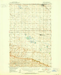
1950 Map of Portal
USGS Topo · Published 1950About this map
Portal stands as a vital rail hub on the international boundary between the United States and Canada, where the Soo Line and Minneapolis St Paul and Sault Ste Marie railroads intersect. This 1950 survey documents a landscape defined by the prairie’s natural drainage and its emerging industrial footprint, particularly the strip mines and pit mines clustered near Lignite. The presence of the Swedish Cem and Norwegian Cem alongside Tonset Ch speaks to the specific immigrant heritage of Burke County during the mid-century era.
Find a feature on this map
39 named features on this map. Tap any name to fly to it.
Don’t see what you’re looking for? This feature index may not catch every label — zoom into the map to look around manually.
Map Details
Editions of this 1950 Portal Map
2 editions found
Other maps of this area

1947 · Flaxton
USGS Topo · 1:24,000

1947 · Columbus
USGS Topo · 1:24,000

1948 · Flaxton
USGS Topo · 1:24,000

1948 · Beaver Lake
USGS Topo · 1:24,000

1948 · Woburn
USGS Topo · 1:24,000

1948 · Stampede
USGS Topo · 1:24,000

1949 · Rennie Lake
USGS Topo · 1:24,000

1949 · Portal
USGS Topo · 1:24,000

1949 · Columbus
USGS Topo · 1:24,000

1949 · Columbus SE
USGS Topo · 1:24,000