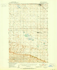
1950 Map of Portal
USGS Topo · Published 1950About this map
The Canada United States border defines the northern edge of this survey, where the international gateway of Portal serves as a critical junction for the Minneapolis St Paul and Sault Ste Marie railroad. The landscape south of the border is a mosaic of prairie townships like Ross, Fay, and Vale, heavily influenced by early coal extraction and agricultural settlement. The presence of a Pit Mine and several Strip Mines near Lignite points to the area's industrial roots, while numerous rural schoolhouses such as Lincoln Sch and Scandia Sch underscore the density of the homesteading community during this era.
Find a feature on this map
41 named features on this map. Tap any name to fly to it.
Don’t see what you’re looking for? This feature index may not catch every label — zoom into the map to look around manually.
Map Details
Editions of this 1950 Portal Map
2 editions found

Other maps of this area

1947 · Flaxton
USGS Topo · 1:24,000

1947 · Columbus
USGS Topo · 1:24,000

1948 · Flaxton
USGS Topo · 1:24,000

1948 · Beaver Lake
USGS Topo · 1:24,000

1948 · Woburn
USGS Topo · 1:24,000

1948 · Stampede
USGS Topo · 1:24,000

1949 · Rennie Lake
USGS Topo · 1:24,000

1949 · Portal
USGS Topo · 1:24,000

1949 · Columbus
USGS Topo · 1:24,000

1949 · Columbus SE
USGS Topo · 1:24,000