
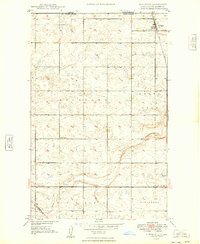
1948 Map of Woburn
USGS Topo · Published 1948About this map
The Great Northern railroad cuts a diagonal line across this 1948 survey of Burke County, defining the rural transport network of north-central North Dakota. The small settlement of Woburn serves as a local hub along the rail line, surrounded by a landscape dotted with small prairie potholes and low ridges. The distribution of educational buildings, including Woburn Sch, Scandia Sch, Clayton Sch, and School No 3, illustrates the dense network of one-room schoolhouses required to serve a dispersed farming population in the mid-20th century.
Find a feature on this map
9 named features on this map. Tap any name to fly to it.
Don’t see what you’re looking for? This feature index may not catch every label — zoom into the map to look around manually.
Map Details
Editions of this 1948 Woburn Map
This is the sole edition of this map. No revisions or reprints were ever made.
Other maps of this area

1947 · Flaxton
USGS Topo · 1:24,000

1948 · Flaxton
USGS Topo · 1:24,000

1948 · Coteau
USGS Topo · 1:24,000

1948 · Vanville NE
USGS Topo · 1:24,000

1949 · Rennie Lake
USGS Topo · 1:24,000

1949 · Portal
USGS Topo · 1:24,000
1949 · Northgate
USGS Topo · 1:24,000

1950 · Vanville NE
USGS Topo · 1:24,000

1950 · Flaxton
USGS Topo · 1:62,500

1950 · Portal
USGS Topo · 1:62,500